Marrakech, quarter by quarter
Marrakech neighbourhoods, from the medina to the Palmeraie.
Marrakech is two cities: the walled medina, founded around 1070, and the districts that grew outside its walls in the 20th century. Here is what each quarter is, a line of its history, what to see, how it feels by day and after dark, and how to get there.
The shape of the city
The medina, the new town and the gardens around them
The medina is ringed by some 19 km of ramparts first built by the Almoravids, with Jemaa el-Fna near its centre. Guéliz and Hivernage lie about 2 km west of the square; the Palmeraie spreads about 7 km to the north, and the Agdal Gardens run south from the royal Kasbah.
- 1Jemaa el-Fna and the Koutoubia
- 2Mouassine
- 3Bab Doukkala
- 4Ben Youssef and the north medina
- 5Riad Zitoun
- 6The Kasbah
- 7The Mellah
- 8Guéliz (the new town)
- 9Hivernage
- 10The Palmeraie
- 11Agdal
Founding date and ramparts: Marrakesh (Wikipedia). Distances on this page are straight lines from Jemaa el-Fna to a named landmark in each area.
Inside the walls
The medina and its quarters
Seven quarters, from the square north through the souks to Ben Youssef, and south to the old royal city of the Kasbah and the Mellah. Inside the walls you walk: none of them is more than about 1.1 km from the square in a straight line, though the lanes make every walk longer.
01The reference point for every distance on this page
Jemaa el-Fna and the Koutoubia
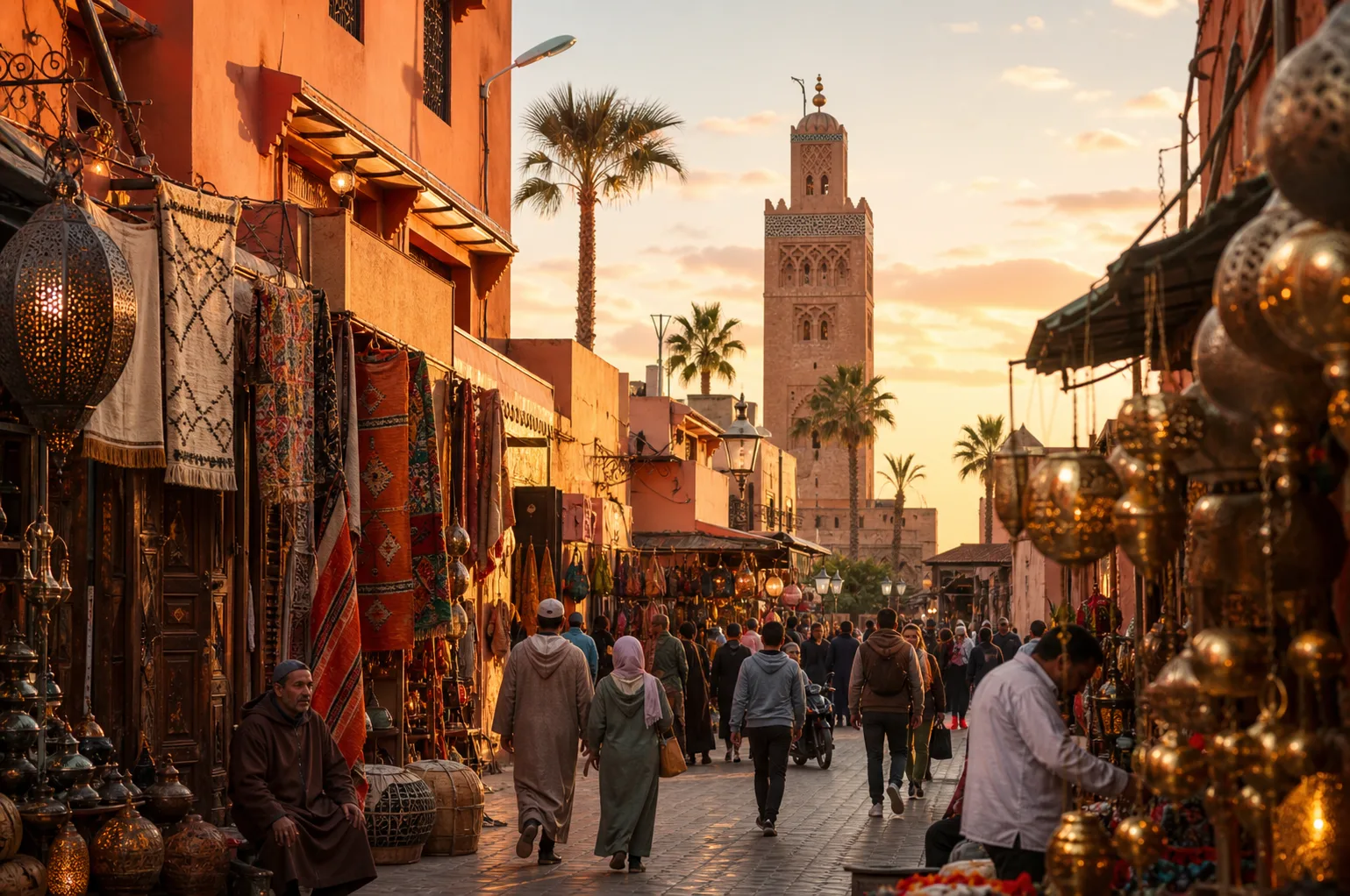
The main square of the medina and the streets around it, with the Koutoubia Mosque a short walk to the west. Most first visits start here.
History: The square was a market and gathering place under the Almoravids and Almohads; UNESCO proclaimed it intangible cultural heritage in 2001 and inscribed it on its list in 2008. The Koutoubia was founded in 1147 by the Almohad caliph Abd al-Mu’min.
What to see
- Jemaa el-Fna itself
- The Koutoubia minaret, about 77 m tall, about 200 m west of the square (non-Muslims cannot enter the mosque)
- By day
- Juice stalls, water sellers and snake charmers hold the square in daytime; it is open, bright and busy.
- After dark
- From late afternoon storytellers and musicians gather, and in the evening dozens of food stalls open and the crowds peak.
- Getting there
- Taxis drop at the edges of the square; from there the medina is on foot.
Sources: Jemaa el-Fnaa (Wikipedia) · Koutoubia Mosque (Wikipedia)
02About 0.4 km north of the square
Mouassine
A residential quarter of the western medina and one of the main ways into the souks, known for its Saadian-era houses.
History: Until the mid-16th century the area had many Jewish residents. The Saadian sultan Abdallah al-Ghalib moved the community to the new Mellah and rebuilt the quarter, with the Mouassine Mosque (1562–63 to 1572–73) and its fountain at its heart.
What to see
- The Mouassine Fountain, a 16th-century street fountain on the north side of the mosque complex
- Dar el Bacha and the Mouassine Museum, a 16th–17th-century house
- The way into the souks
- By day
- Lanes of houses and workshops, quieter than the souk streets a few minutes east.
- After dark
- A residential quarter: once the shops close, its lanes are calm and dimly lit.
- Getting there
- On foot from the square, heading north into the lanes on the western side of the souks.
Sources: Mouassine (Wikipedia) · Mouassine Mosque (Wikipedia) · Marrakesh (Wikipedia)
03About 0.8 km north-west of the square
Bab Doukkala
The quarter behind Bab Doukkala, one of the medina’s main historic gates, on the western side that faces Guéliz.
History: Its Friday mosque was begun in 1557–58 by Lalla Mas’uda, mother of Ahmad al-Mansur, as the centre of a newly rebuilt neighbourhood with a madrasa, hammam, library and fountain.
What to see
- The Bab Doukkala Mosque and its carved street fountain, with basins for animals and one for people
- The gate itself, in the medina walls
- By day
- A neighbourhood built round one of the historic gates, on the side of the medina facing the new town.
- After dark
- Residential lanes; most visitors pass through in daytime.
- Getting there
- On foot from Mouassine, or by taxi to the gate from Guéliz, about 1.2 km away.
Sources: Bab Doukkala Mosque (Wikipedia) · Marrakesh (Wikipedia)
04About 0.75 km north of the square, beyond the souks
Ben Youssef and the north medina
The area around the Ben Youssef Mosque and madrasa. The souks grew up between Jemaa el-Fna and this mosque, so the walk here runs through them.
History: The Almoravid ruler Ali ibn Yusuf built the Ben Youssef Mosque between 1120 and 1132 as the city’s main mosque. The madrasa beside it was completed in 1564–65 under Abdallah al-Ghalib.
What to see
- By day
- Visitors walk up through the souks to the madrasa; the streets beyond are workshops and homes.
- After dark
- Far from the square’s bustle; most visitors head back south once the sights close.
- Getting there
- A walk north from the square through the souks, or taxi to the nearest road and walk in.
Sources: Ben Youssef Madrasa (Wikipedia) · Medina of Marrakesh (Wikipedia) · Marrakesh (Wikipedia)
05About 0.75 km south-east of the square
Riad Zitoun
The lanes south-east of the square around Rue Riad Zitoun el-Jedid, which leads towards the Bahia Palace and the Mellah.
History: The Bahia Palace was begun in the 1860s by the grand vizier Si Musa and extended in the 1890s by his son Ba Ahmed; its growth took over the neighbourhood north of the Mellah. Dar Si Said nearby was built between 1894 and 1900.
What to see
- The Bahia Palace
- Dar Si Said, a late 19th-century palace that houses the National Museum of Weaving and Carpets (check it is open before you go)
- By day
- A through-route on foot between the square and the palaces.
- After dark
- Close to the square, so the northern end stays lively into the evening.
- Getting there
- Walk south-east from the square; the Bahia Palace is at the far end.
Sources: Rue Riad Zitoun el-Jedid (OpenStreetMap) · Bahia Palace (Wikipedia) · Dar Si Said (Wikipedia)
06About 1.1 km south of the square
The Kasbah
A large walled district in the southern part of the medina, built as the royal citadel.
History: The Almohads built it in the late 12th century, mostly under Ya’qub al-Mansur (r. 1184–1199). The Saadians added their royal tombs and Ahmad al-Mansur’s El Badi Palace (1578–1593), later stripped by Moulay Isma’il.
What to see
- Bab Agnaou, the old main gate, and the Kasbah Mosque
- The Saadian Tombs, on the south side of the Kasbah Mosque
- The ruins of the El Badi Palace
- The royal palace is not open to the public
- By day
- Sightseeing traffic to the tombs and El Badi, with quieter residential lanes around them.
- After dark
- Calmer than the northern medina once the monuments close.
- Getting there
- On foot from the square (longer than the straight line through the lanes), or a taxi to Bab Agnaou.
Sources: Kasbah of Marrakesh (Wikipedia) · Saadian Tombs (Wikipedia) · El Badi Palace (Wikipedia)
07About 0.9 km south-east of the square
The Mellah
The historic Jewish quarter, east of Place des Ferblantiers and beside the El Badi Palace walls.
History: It was created in 1558 under the Saadian sultan Abdallah al-Ghalib, on the site of the sultan’s stables. Renamed Hay Essalam, it had its old name, El Mellah, restored in 2016.
What to see
- The Slat al-Azama (Lazama) Synagogue, still an active synagogue
- The Jewish cemetery
- By day
- A lived-in quarter of narrow streets; in the 16th and 17th centuries it was one of the city’s main commercial areas.
- After dark
- Quiet and residential after dark; most visitors come in daytime.
- Getting there
- On foot from the Bahia Palace or the Kasbah, both close by.
Sources: Mellah of Marrakesh (Wikipedia) · Lazama Synagogue (Wikipedia) · Marrakesh (Wikipedia)
See the quarters with a guide
A private guide can link Mouassine, the souks and Ben Youssef in a morning, and the Kasbah, the Mellah and the Bahia Palace in an afternoon, without working out the lanes yourself.
Outside the walls
Guéliz, Hivernage, the Palmeraie and Agdal
The new town grew west of the ramparts after the 1913 plan; the palm grove is traditionally dated to the city’s founding, and the Agdal Gardens to the 12th-century Almohads.
08About 1.9 km west-north-west of the square
Guéliz (the new town)
The commercial centre of modern Marrakech and the oldest part of the new town, with most of the city’s banks and shops.
History: It was the first district built outside the ramparts, in the French Protectorate period; the new town was designed in 1913 by Henri Prost. The name comes from the hill to the north-west, Jbel Gueliz.
What to see
- The Jardin Majorelle, begun by the painter Jacques Majorelle in 1923 and later restored by Yves Saint Laurent and Pierre Bergé
- Avenue Mohammed V, which runs from the Koutoubia to Jbel Gueliz
- Marrakech railway station
- By day
- Wide avenues, offices, cafés and shops: an ordinary modern city centre.
- After dark
- Most of the city’s bars and late venues are here and in Hivernage rather than in the medina.
- Getting there
- A short petit taxi ride from the medina, or a walk up Avenue Mohammed V from the Koutoubia.
Sources: Guéliz (Wikipedia, French) · Marrakech (Wikipedia, French) · Majorelle Garden (Wikipedia) · Gare de Marrakech (OpenStreetMap)
09About 1.8 km west of the square
Hivernage
An affluent district of villas and large hotels west of Bab Jdid and south of Guéliz, crossed by Avenue Mohammed VI.
History: Part of the new town that grew outside the walls in the 20th century. Its green spaces include Jnan El Harti, a park of about 6 hectares from the 1930s in the Guéliz and Hivernage area.
What to see
- The Menara Gardens, about 1.6 km further south-west, with their Almohad-era reservoir and 1870 pavilion
- Jnan El Harti park
- By day
- Hotel gardens and quiet avenues; little street life by day.
- After dark
- One of the two districts where the city’s nightlife concentrates.
- Getting there
- Petit taxi from the medina or Guéliz; it is also walkable from Bab Jdid.
Sources: Marrakech (Wikipedia, French) · L’Hivernage (OpenStreetMap) · Menara gardens (Wikipedia) · Marrakesh (Wikipedia)
10About 7 km north-north-east of the square
The Palmeraie
The palm grove north of the city, in the Ennakhil district, now also a zone of resorts, villas and golf courses.
History: It is traditionally dated to the Almoravid founding of the city around 1070, as an oasis watered by underground channels (khettaras). Building on the grove has spread, and diverts part of its water.
What to see
- By day
- Open, green and spread out: a contrast to the medina.
- After dark
- Dark and quiet outside the resorts; there is no street life to walk to.
- Getting there
- By car or taxi only; agree the return trip in advance.
11About 2.4 km south-south-east of the square
Agdal
The Agdal Gardens, a walled royal estate of orchards and reservoirs immediately south of the Kasbah and the royal palace.
History: The present gardens were laid out by the Almohads under Abu Ya’qub Yusuf (1163–1184). They cover about 340 hectares inside a wall some 9 km long, and are part of the UNESCO World Heritage listing of the medina, with the Menara Gardens.
What to see
- By day
- Orchards and water basins on a gentle slope towards the mountains; there is a long tradition of public access, but ask locally whether the gates are open on your day.
- After dark
- A walled garden, not an evening destination.
- Getting there
- By taxi, or on foot from the south side of the Kasbah.
Sources: Agdal Gardens (Wikipedia) · Marrakech (Wikipedia, French)
Choosing a base
Where to stay, by neighbourhood
This page describes the areas; these guides compare them as places to sleep.
Marrakech neighbourhoods: your questions
What are the main neighbourhoods of Marrakech?
Two halves: the walled medina, with quarters such as the area round Jemaa el-Fna, Mouassine, Bab Doukkala, Ben Youssef in the north, Riad Zitoun, the Kasbah and the Mellah in the south; and the districts outside the walls, chiefly Guéliz (the new town), Hivernage, the Palmeraie to the north and the Agdal Gardens to the south.
What is the difference between the medina and Guéliz?
The medina is the old walled city, founded around 1070, with lanes mostly walked on foot. Guéliz was the first district built outside the ramparts, in the French Protectorate period; it is the modern commercial centre with avenues, banks, shops and the railway station, about 2 km from Jemaa el-Fna.
Which neighbourhood is Jemaa el-Fna in?
It is the main square of the medina, roughly central to the old city: the souks spread north of it, the Koutoubia stands about 200 m to the west, and Riad Zitoun leads south-east towards the Bahia Palace and the Mellah.
What is the Mellah in Marrakech?
The historic Jewish quarter, created in 1558 under the Saadian sultan Abdallah al-Ghalib beside the palace district in the south of the medina. Its Lazama Synagogue is still active, and the quarter had its name, El Mellah, restored in 2016.
How far is the Palmeraie from the medina?
About 7 km in a straight line north-north-east of Jemaa el-Fna. It is spread out and not walkable from the city, so plan on a car or a taxi both ways.
Can you walk between the neighbourhoods?
Within the medina, yes: every quarter on this page is within about 1.1 km of the square in a straight line, though the lanes make walks longer. Guéliz and Hivernage are about 2 km away, a walk or a short taxi ride. The Palmeraie and the Agdal Gardens are best reached by car.
Tell us which quarters you want to see.
المغربⵜⴰⴳⵍⴷⵉⵜ ⵏ ⵍⵎⵖⵔⵉⴱThe Kingdom of Morocco